Trail Conditions
NEW! The club has a Nordic Pulse page. This great tool provides skiers with a map showing trails, trail difficulty, and grooming status. Colour-coded trails show readers when trails were last groomed. It can be accessed via computer or on your Android or Apple device.
Reading this on your phone? Download the app from the Apple Store or Google Play.
You can also click here for the most recent trail conditions update or phone the Park at 613-267-5060. Our Facebook page also has the latest news and updates. Local weather information is available here: Environment Canada.
Trail Etiquette
Please read this article on winter trail etiquette published by Ontario Parks. For a summary visit our page on trail etiquette.
Trail Network
Click HERE to get a printable PDF version of the map below to take with you on the trails when you ski or snowshoe.

DESCRIPTION: Our 22 km network consists of 12 km of trail track set for classic skiing and 6 km groomed for skate skiing. In addition, there are 10 km of backcountry trails. We recommend that skiers who enjoy the solitude and tranquility of nature should take advantage of the Round Lake loop suitable for intermediate backcountry skiers.
Our trail network is located at Murphys Point Provincial Park on the shores of the Big Rideau Lake in eastern Ontario. Located on the Frontenac Arch extending southeastward from the Canadian Shield, it offers an ideal environment for recreational and competitive skiing or snowshoeing. Our network of trails provides access to several interesting archaeological sites as well as restored heritage buildings left open for rest and shelter on the trail.
ARRIVAL: When you arrive at the Park, turn left just before the main entrance to enter the clearly marked winter parking lot. Your club membership card must be displayed in your vehicle window to show that you have paid a park user fee. Otherwise, you must purchase a Park Day Use Permit at the self-serve reception kiosk in this parking lot. Trail maps and other information are available here. This parking lot serves as the primary trailhead.
There is a second trailhead further along County Road 21 at the Lally Homestead. Skiers who do not have a Club Membership or Park Pass will need to drop by the self-serve kiosk at the main winter parking lot to make their daily payment prior to heading to this trailhead.
An important attraction of this venue for the beginner skier is the picturesque and wooded Lally Heritage Loop. This 800 metre loop is located behind the two existing heritage buildings. We recommend a clockwise direction for easier skiing. Of course, intermediate skiers who prefer the longer and more rugged backcountry experience can choose the Round Lake Loop which starts across the road from the Lally parking lot.
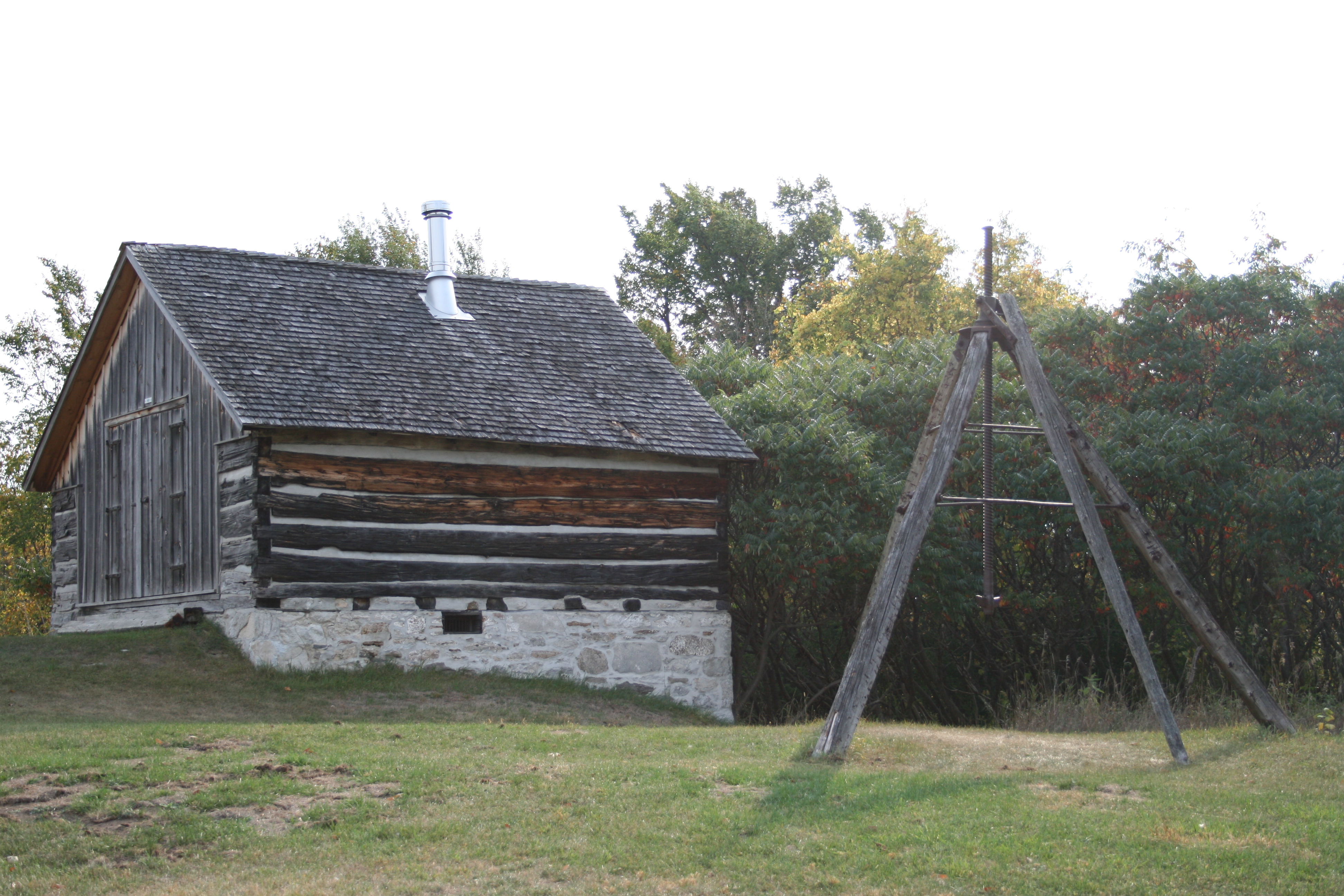
FACILITIES: The Lally Barn serves as a great base for your ski or showshoe adventure. Inside the small barn are picnic tables and wood stove (including wood, kindling, and paper). Just remember to bring matches so that you can start the fire in the shelter before setting out on your excursion. There are toilets available adjacent to the parking lot.
PLEASE NOTE: Hiking and dogs are not permitted on the ski trails to ensure safe, quality skiing trails. Snowshoers are welcome to travel, where necessary, beside the groomed portion of the trails to access nature trails and roads not used by skiers. Please stay off the groomed portion of the trail.
How to Find Us
(Address to enter in Google Maps: 2243 Elm Grove Rd, Perth, ON K7H 3C7)
From Ottawa, take Hwy. 7 to Perth then follow Provincial Park signs. Turn left onto Wilson, left onto Foster, right onto Gore. Gore turns into County Road 1 (Rideau Ferry Road), then 6 km outside Perth, turn right on County Road 21 (ElmGrove Road). Follow this road 12 km to the Park.
From Kingston or Smiths Falls take Hwy. 15 to Lombardy, follow park signs West on County Road 1 (Rideau Ferry Road) through Rideau Ferry, left onto County Road 21 (ElmGrove Road) and 12 km to the Park.

